In 1884 a workman renovating a Greek Orthodox church in Madaba, central Jordan, lifted a section of the floor and uncovered a mosaic depicting Jerusalem from above — the holy city's gates, its Cardo Maximus, the Damascus Gate, the Tomb of David. The work continued through the 1890s and revealed something larger than anyone in Madaba expected: a Byzantine map of the entire Holy Land, originally 21 by 7 metres across, made of more than two million stone tesserae.
It is the oldest surviving cartographic depiction of the Holy Land. It is still where it was found — in the floor of the church, with the congregation seated above it on Sunday mornings.
1Why visit the Madaba Map
The Madaba Map is the only piece of Byzantine cartography of the Holy Land that survives from before the Arab conquest. Created between 542 and 570 CE, it predates the Crusades by five hundred years and the printing press by nine hundred. Its survival is accidental — the mosaic was already buried by debris when Arab armies took the region in the 7th century, and the church above it was rebuilt and rebuilt again. It was rediscovered between 1884 and 1896 during construction of a Greek Orthodox church on the same site.1
2What survives, what's labelled
The original mosaic was about 21 by 7 metres; the surviving portion is approximately 16 by 5 metres, composed of more than two million tesserae. The cartography is unusual in two respects:
- Orientation. The map faces east toward the altar, not north. East is "up" — a Byzantine convention that places Jerusalem at the visual centre.
- Coverage. The map runs from Lebanon to the Nile delta north-to-south and from the Mediterranean to the eastern desert. Approximately 150 towns and villages are labelled in Greek, including Jerusalem, Bethlehem, Jericho, the Dead Sea, the Jordan River, and the four mouths of the Nile.
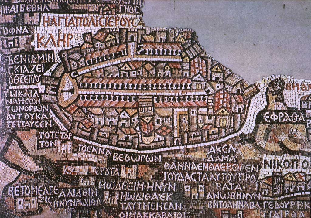
3The Jerusalem detail
The Jerusalem detail is the most-photographed part — and the most extensively studied. The mosaic shows the city walled, with two prominent gates (the Damascus Gate and another in the south), the Cardo Maximus running through the centre as a colonnaded street, and the Church of the Holy Sepulchre as a domed structure on the western side. For archaeologists working on Byzantine Jerusalem, the Madaba Map is a primary source — it preserves details of the urban layout that have since been lost.
4Getting there + visiting the church
The Madaba Map is on the floor of St. George's Greek Orthodox Church in central Madaba. Visitors are welcome outside service hours; on Sunday mornings the congregation gathers above the mosaic and visitors are asked to wait until after the service. There is a small entrance fee (a few JD) — it goes to the church.
The church is in the centre of Madaba town, an easy walk from the bus station or any hotel. Allow 30–45 minutes for a slow read of the mosaic — if you bring a guidebook with the labelled diagram, longer.
5Combine with Mount Nebo
Madaba is 8 km from Mount Nebo (the summit where Moses is said to have looked across to the Promised Land). The classic itinerary from Amman is:
- Morning. Drive to Madaba (45 min from Amman). St. George's Church + the Madaba Archaeological Park (additional Byzantine mosaics).
- Late morning. Drive to Mount Nebo (15 min). Memorial Church of Moses + the Brazen Serpent monument.
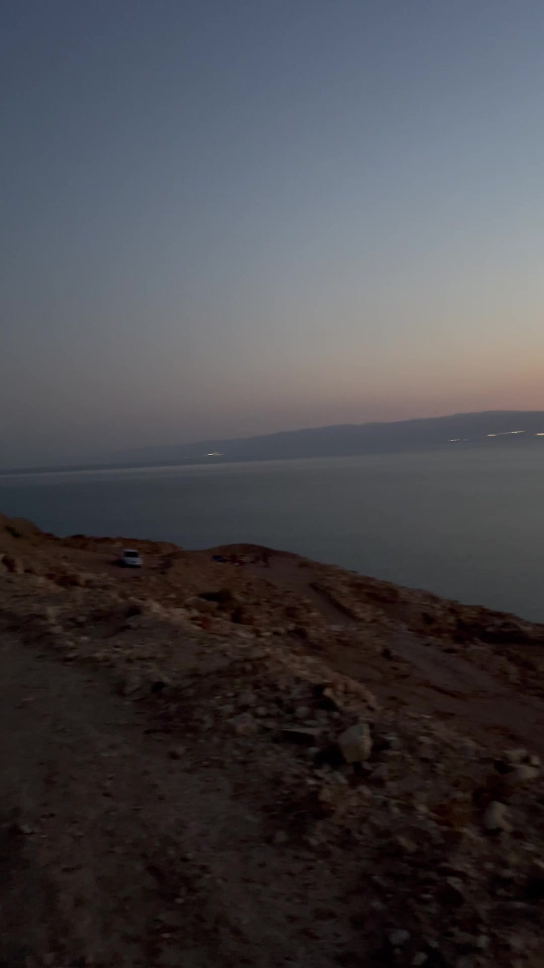
- Afternoon. Either continue to the Baptism Site at Bethany-Beyond-the-Jordan (40 km west), or to the Dead Sea for floating + sunset. Both are doable as the third stop on a single day from Amman.
For solo travellers
Bring a guidebook with the labelled mosaic diagram — Lonely Planet's is good. Or download a printout from a museum site before arrival; reading the Greek place-names is much of the pleasure.
For couples
Madaba's Old Town has good cafés and a few small craft shops. Pair the church with lunch at one of the rooftop spots overlooking the cathedral square.
For families with kids
The Madaba Map is best with a "treasure hunt" approach: print or photograph the labelled diagram and challenge kids to find Jerusalem, the Dead Sea fishes (yes, fishes), and the Nile delta. Engagement spikes immediately.
For adventure travellers
Add the Madaba Archaeological Park (10-min walk from the church) for additional Byzantine mosaics and the partially-excavated Roman streets under the modern town. Half-day in total.
Accessibility notes
The church has step-free entry and the mosaic is viewed from the surrounding pew area. The town centre around the church is largely flat with paved sidewalks.
6Practical tips
- Service hours. Sunday mornings are off-limits to visitors during the Greek Orthodox Liturgy. Plan a Saturday or weekday afternoon.
- How long. 30–45 minutes for the map; allow 2–3 hours for Madaba town including lunch.
- Photography. Permitted without flash. Tripods can be set up if it's not busy; ask the church custodian.
- Combine with. Mount Nebo (8 km / 15 min) and the Madaba Archaeological Park (5-min walk) for a full half-day.
- Light source. The mosaic is lit by daylight from the church windows. Cloudy afternoons soften the colours; bright midday sunlight washes them out.
References
Verified by locals: TBD — this article will be reviewed by a Greek Orthodox Patriarchate-affiliated guide or Department of Antiquities-affiliated archaeologist before final publication. Drafted from Wikipedia.

Comments (0)